 Mount Batur Sunrise Hike Tours
Mount Batur Hike Difficulty
Last reviewed August 2026
The honest answer on Mount Batur hike difficulty is moderate, and the difficulty is not where beginners expect it. You climb roughly 500 to 600 metres over two to three kilometres to a 1,717 metre summit, which is a gradient rather than a challenge. What makes people struggle is the combination around it: the first ninety minutes happen by headlamp, the last twenty minutes are loose volcanic rock, and you are doing all of it on about four hours of sleep.
Quick answer The numbers, the hard parts, and the fitness test that actually predicts it
Mount Batur is a moderate hike: about 500 to 600 metres of ascent over two to three kilometres, taking 1.5 to 2.5 hours up and 1 to 1.5 hours down. There is no scrambling, no exposure and no altitude problem at 1,717 metres. The two genuinely hard parts are the final twenty minutes of loose volcanic scree and the descent on the same surface in daylight with tired legs. If you can climb stairs steadily for an hour without stopping, you can do this.
Key takeaways
- Gain 500 to 600 m over 2 to 3 km, on a trail that never requires hands
- The descent hurts more than the climb, which is why the Mount Batur sunrise hike tours hand out trekking poles
- Operators refuse pregnant travellers and people with back, heart or mobility problems; one listing also excludes under-eights and over-65s
- Cold rather than gradient is the most common complaint: see what to wear
- Cannot manage a steep unlit trail? The sunrise jeep reaches the caldera floor with no climbing
The Numbers, Before the Opinions
What you are actually climbing
The summit stands at 1,717 metres. The standard trailhead near Toya Bungkah sits at roughly 1,150 to 1,200 metres, so the climb is 500 to 600 metres of vertical over two to three kilometres in each direction. Groups take 1.5 to 2.5 hours to reach the rim and 1 to 1.5 hours to come back down.
For comparison, that is about the same vertical as walking up a 170-storey building, spread over an hour and a half. It is real work and it is not mountaineering. Nobody uses a rope, nobody needs hands on rock, and at this height altitude does nothing to you.
The common mistake is reading moderate as easy. Every listing among the guided Mount Batur sunrise treks uses the phrase moderate fitness, and one of them adds come ready for steep inclines and a vigorous hike, which is the more accurate description.
| What you face | The detail | Who finds it hard |
|---|---|---|
| Elevation gain | 500 to 600 m from the trailhead | Anyone who never walks uphill at home |
| Distance | 2 to 3 km each way | Rarely the limiting factor |
| Time on your feet | 3.5 to 4.5 hours including the summit stop | Anyone under-slept and unfed |
| Surface | Packed earth, then loose volcanic scree | Weak ankles and smooth-soled shoes |
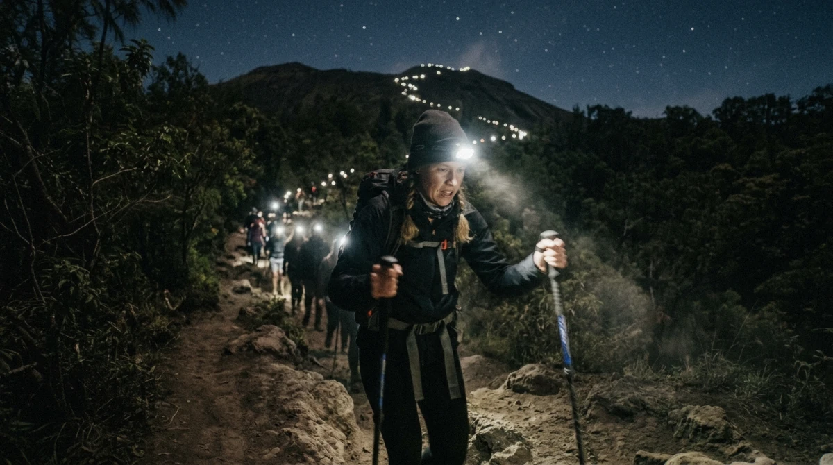
| Darkness | Headlamp for the first 90 minutes | First-time night hikers |
| Cold at the top | 10 to 15°C with wind | Everyone who packed for a beach holiday |
The Trail, Section by Section
The forest, roughly 04:00 to 05:00
The first section climbs through trees on packed earth. It is sheltered from the wind, the gradient is steady, and the ground is even enough that you look at the back of the person in front rather than at your feet.
This is where groups spread out and where pace gets set. If you are going to be at the back, be at the back here rather than trying to keep up and paying for it later. Rest huts appear along the way with simple toilets and small shops.
Most people find this part easier than they feared. It is also where you should shed a layer, because you will be warm within fifteen minutes and cold the moment you stop at the top.
The open slope, roughly 05:00 to 05:20
The trees end and the mountain opens up. Lake Batur appears below as a dark shape, wind arrives, and the trail narrows onto the flank of the cone.
The gradient increases here and the surface changes from earth to a mix of gravel and volcanic rock. It is still walking, but it is now walking where each step gives a little.
There are also two approaches in general use on this side of the mountain. A more direct line goes up the flank with a steeper gradient, and a longer route switchbacks its way to the rim at a gentler angle. Which one your group takes is your guide's call on the morning, based on conditions and the group's pace, and it is a fair thing to ask about at the trailhead if you have a knee that prefers switchbacks.
The last twenty minutes
This is the part people remember. The path turns rocky and loose, the wind is now constant, and you can see head-torches above you on the rim which makes the remaining distance look both shorter and longer than it is.
Nobody needs technical skill here. What they need is patience and short steps. Guides slow down deliberately at this point, and if the group is small they will stop as often as anybody needs. On the standard shared departures the pace is an average of twenty-odd people, which is one practical argument for the five-person small group.
A motorbike lift up this final stretch is offered on the mountain to anyone who looks like they are struggling. It is negotiated in cash on the spot. It exists because enough people need it, which is worth knowing before you decide this is beyond you.
The Descent Is the Part People Underestimate
Why coming down is harder than going up
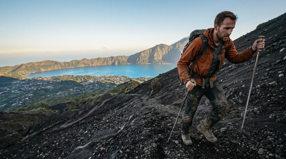
On the way up, loose scree is annoying. On the way down, in daylight, with legs that have already done 600 metres of climbing, the same surface behaves like ball bearings.
This is where the falls happen on Mount Batur, and they are almost always slips rather than anything dramatic: a foot goes, a hand goes down, and somebody finishes the morning with a grazed palm and a bruised backside. Serious injuries are rare. Undignified ones are common.
Three things prevent it. Take the trekking pole your guide handed you at the trailhead, even though you felt silly carrying it up. Wear shoes with actual tread; trainers are fine, the flip-flops that a surprising number of people arrive in are not. And go down at the speed your legs want rather than the speed of whoever is behind you.
What tired legs feel like the next day
Quadriceps and calves, mostly, and it lands the following morning rather than the same afternoon. The descent does the damage rather than the climb.
The practical version of this: do not schedule anything that involves stairs, long walks or a scooter on unfamiliar roads for the day after. And if your legs are the part of you that objects loudest, the hike with a hot spring included puts you in warm mineral water about an hour after you come off the mountain, which is not a marketing line but a genuinely effective one.
A Two-Week Readiness Check
If you are not sure you are fit enough
None of this requires a gym. It requires knowing, before you are standing in the dark at 04:00, whether your body does uphill.
- Climb stairs steadily for one hour without stopping, and note how you feel at the forty-minute mark
- Walk two to three kilometres on an incline in the shoes you plan to hike in, so you learn where they rub
- Do one walk that starts before dawn, so the hour itself is not a new experience on the day
- Test your headlamp discipline by walking a dark path at home; some people find the tunnel of light disorientating
- Check that your travel insurance covers volcano trekking, which many standard policies exclude as an adventure activity
- Practise going downhill on a loose or gravel surface if you can find one, because that is the actual hazard
The fitness test that actually predicts it
One hour of continuous stairs. Not a run, not a gym class. If you can do that at a conversational pace, you will reach this summit comfortably. If you can do it but it hurts, you will reach the summit and enjoy the second half more than the first.
If you cannot, that is useful information rather than a verdict. The jeep tour reaches a sunrise viewpoint on the caldera floor with no walking at all, and it costs less than the trek.
Who the Operators Refuse
The published limits
These are not our rules. They are lifted from the listings themselves, and they are the clearest signal of what the mountain asks.
| Listing | Who it will not take |
|---|---|
| Classic sunrise trek | Pregnancy, back problems, mobility impairments, heart problems, wheelchair users |
| Trek with hot spring | As above, plus children under two; adult pricing applies to everyone |
| Small-group trek | Children under eight and travellers over 65 |
| Kayu Padi route | Mobility impairments and a low level of fitness |
| Trek with Tibumana Waterfall | Pre-existing medical conditions, pregnancy, heart or back problems |
| Sunrise jeep | Travellers over 70, back problems, altitude sickness |
Reading the refusals honestly
An operator that publishes who should not come is being more useful than one that takes everybody's money and works it out at 04:30 on a dark slope. The overlap in those lists is the real answer to the difficulty question: this is a hike where a bad back or a heart condition matters, and where age at either end is a genuine consideration.
If you fall outside one operator's limits, check the others rather than assuming the mountain is closed to you. The classic trek allows fit children with an adult, for example, where the small-group version does not.
Which Version Suits Your Legs
If You walk regularly and want the summit without a crowd setting your pace
Take the small-group trek capped at five, so stops happen when you need them.
If You are fit but hate busy trails
Take the Kayu Padi route, a quieter approach to the same rim.
If You are unsure about your knees on a scree descent
Book a trek anyway, use the pole, and go down last. Alternatively the jeep removes the descent entirely.
If You want the climb and a recovery afterwards
The trek with a hot spring puts you in warm mineral water within about an hour of coming down.
Questions About the Climb
How long does it take to walk up Mount Batur?
Between 1.5 and 2.5 hours to the summit depending on the group, and 1 to 1.5 hours to come back down. Add about an hour on the rim for sunrise and breakfast, which puts you on the mountain for roughly four hours in total. Guides set the pace around the slowest walker, so a fit group moves faster than the range suggests.
How much elevation gain does the Mount Batur hike have?
Roughly 500 to 600 metres. The summit is 1,717 metres and the standard trailhead near Toya Bungkah sits at about 1,150 to 1,200 metres. That gain happens over two to three kilometres, which is what makes the gradient noticeable rather than the distance.
Do you need hiking experience for Mount Batur?
No. There is no scrambling, no exposure and no navigation, since a licensed local guide is compulsory on this mountain. What you need is the ability to keep walking uphill for an hour and a half, shoes with tread, and a willingness to move slowly on loose ground during the descent.
Is the descent from Mount Batur dangerous?
Not dangerous, but it is where people slip. The surface is loose volcanic scree and your legs are tired by then. Use the trekking pole provided at the trailhead, wear shoes with tread rather than smooth soles, and take short steps. Falls on this section are usually grazes rather than injuries.
What happens if I have to turn back?
Tell your guide early rather than at the point of exhaustion. On the standard shared departures somebody can usually walk you back down while the rest continue, and on the mountain itself a motorbike lift up the steepest section is sold in cash to anyone struggling. Turning back is unusual but it is not treated as a drama.
Is Mount Batur harder than other Bali hikes?
It is the most-climbed mountain in Bali precisely because it is at the accessible end of the island's volcano hikes. Mount Agung, at 3,031 metres, is a substantially longer and steeper undertaking. Batur's reputation for difficulty comes from the hour it starts at rather than the terrain.